A winter storm over the holiday weekend dropped more than 30 inches of snow on the mountains that surround Juneau. A fresh dump of snow like that can set the stage for avalanches.
“The snow piles up, and it can’t quite stick to the sides of the slopes. So it can avalanche during a storm,” said Wendy Wagner, director of the Chugach National Forest Avalanche Information Center.
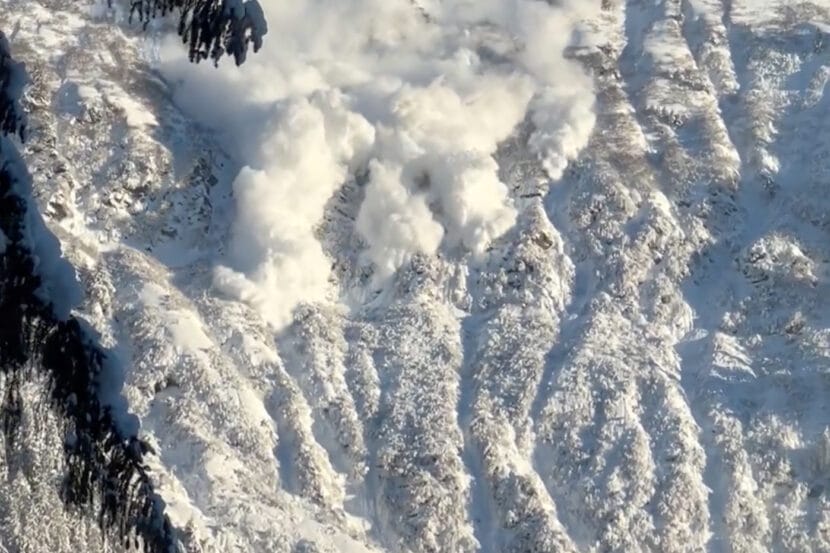
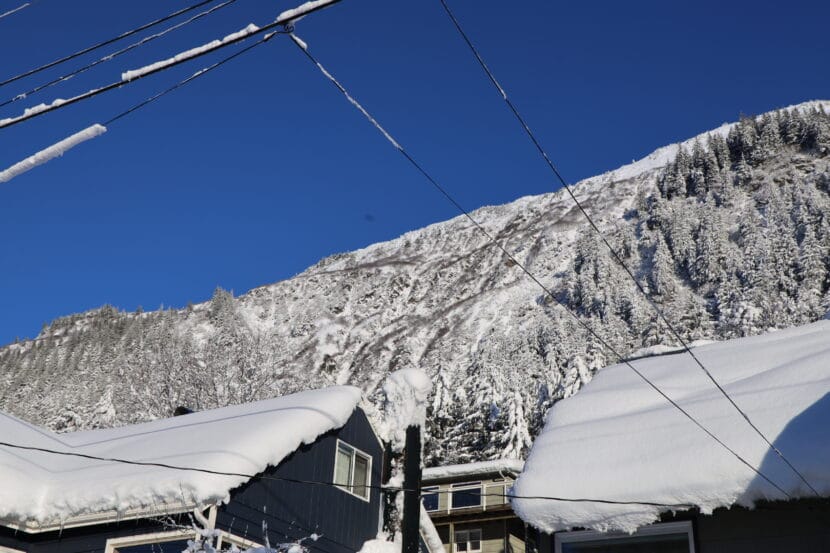
But Juneau’s recent avalanches came down well after the snow had stopped falling. On Tuesday morning, people captured dramatic videos of an avalanche on the Behrends Path on Mt. Juneau coming down under bright, clear skies. Wednesday night, another Behrends slide left cars and houses dusted in up to two inches of snow.
Wagner said these kinds of sunny-day snow slides happen often — because snowfall isn’t the only ingredient in an avalanche.
“The winds can actually create their own avalanche cycle,” she said.
When wind blows across a ridge, it moves snow around, picking it up from the windward side and dropping it on the leeward side, where it forms thicker, heavier drifts.
And it doesn’t take a strong wind to start moving the snow.
“If you have, say, a foot or two feet of nice, loose powder, it’ll only take maybe 20 mile an hour or less winds to pick up that snow and put it somewhere else and pile it up,” Wagner said. “The wind can basically create its own snowstorm on a slope.”
 And the right kind of wind storm can actually deposit snow faster — up to 10 times faster — than a real snow storm, where snow falls from the sky.
“So you can have winds for a few hours,” Wagner said. “And if they’re just right, they can make an avalanche problem pretty quickly.”
Juneau’s recent storm left a lot of cold, dry powder that was easy to blow around. And after the storm subsided, strong winds followed.
Moderate winds on Tuesday loaded up the avalanche paths on Mt. Juneau. Then, on Wednesday and Thursday, the winds got even stronger. The National Weather Service issued a high wind warning, predicting winds between 40 and 55 mph and gusts up to 70 mph.
Winds that fast move a lot of snow around. And strong winds change the quality of the snowflakes, too.
“Snow grains often get broken up, just because they’re colliding with each other,” Wagner said. “They’re a little bit smaller, and so they can pack tighter.”
All those tiny particles bond closely together and form a dense layer of snow known as a wind slab, which puts pressure on the existing snowpack,
“All of the sudden, you have this kind of more dense layer of wind drifting off snow that’s sitting on a less dense, more un-cohesive layer,” Wagner said. “And that’s the perfect recipe for an avalanche.”
But Juneau residents know that an avalanche doesn’t happen every time a strong wind blows. Mike Janes, an avalanche forecaster with Alaska Electric Light and Power, said this week’s avalanches were also caused by problems deep in the snowpack.
“The main reason is that we have kind of a series of these weak layers, with crusts and sugary snow between them,” he said.
In the middle of this weekend’s snowstorm, a spell of freezing rain formed a crust of ice on the snowpack, Janes said. And even deeper down, Juneau’s snowpack has layers of sugar snow, a type of large, angular snow grain that doesn’t stick well with the grains around it. That led to weaker bonds in the snowpack.
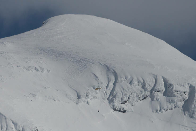
So when the wind built a heavy slab in the Behrends path, it tested those bonds. And it broke them, triggering an avalanche.
Wind is a major factor shaping avalanche risk, but Janes said it’s extremely hard to monitor. In Juneau, though, avalanche forecasters can use the National Weather Service’s Juneau Airport Wind System to get wind speed measurements for the ridges of Mt. Roberts, Eaglecrest and Sheep Mountain to refine their forecasts.
Janes says that’s critical because wind’s role in avalanche’s really depends on its speed, which varies widely across Juneau’s microclimates. Winds between 40 and 60 mph are ideal for building wind slabs, but stronger winds, like the 80 to 100 mph Taku winds that happen along Gastineau Channel, can actually push snow off the ridge. Sometimes, the snow even sublimates back into the atmosphere.
“So like sometimes Thane Road’s more of a wind tunnel,” Janes said. “And a lot of times that will reduce avalanche activity, in some ways, because it’s doing so much stripping.”
Farther up the channel, Mt. Juneau is more sheltered. The winds are more likely to stay in a 40 to 60 mph range, which moves the snow around without blowing it off the mountain.
And that puts Mt. Juneau in the sweet spot for wind-driven avalanches.